Nevada’s Highway 50 is well known as the “Loneliest Road in America.” I felt it, nearly a decade ago when I took a job as a field technician for a wilderness advocacy group based in Reno. I worked in Nye County that summer (this nation’s second largest, and least populated) and drove on a shit ton of dirt roads south of the famed Highway 50. The highway runs East to West, passing through Fallon, Austin, Eureka, and Ely. One of my first nights in Nevada, and the one night it rained that summer, I spent in the back of a Nissan Pathfinder in Ely. Other than that evening, I probably slept under the stars 100 nights that summer. Whenever I drove into Fallon, I knew I was close to Reno, which meant a paycheck, a hot shower, and a new set of maps so that I could go out again, toward “towns” like Duckwater, Round Mountain, Kingston, or the other had-been mining camps whose ruins dotted the flanks of the Toiyabe Mountains. Austin and Eureka, though, they were the real towns that gave the character to Highway 50, giving faces and features to the series of basins and ranges.
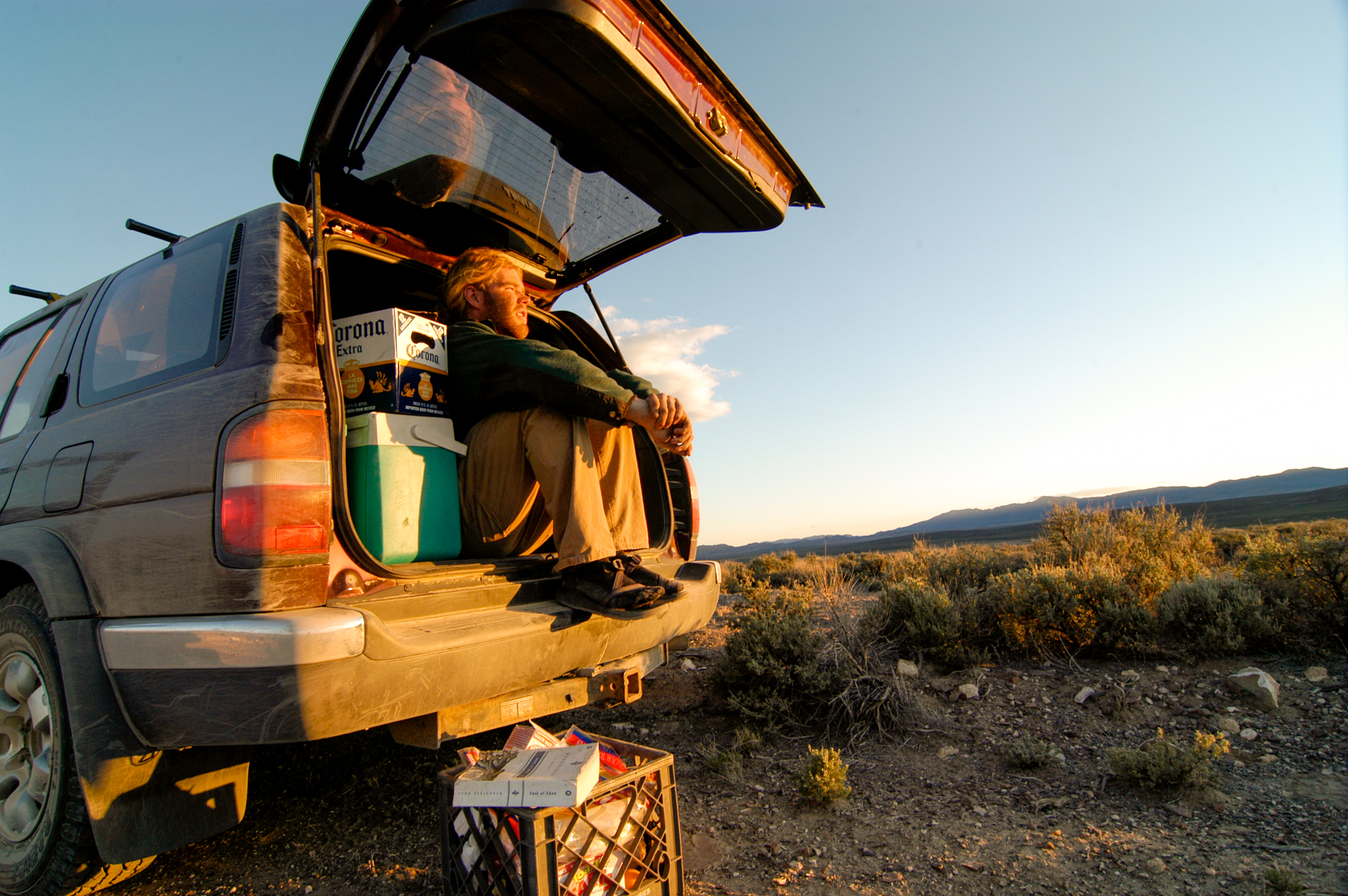
Each town boasted a post office and a library, though only Eureka had a grocery store; it showed me my first tiny rural grocery store, with pint-sized shopping carts, sparse shelves, and a produce selection that left something to be desired. Austin had the International, a moderately famous bar that boasts an ornate bar back that was moved from its original home in Virginia City when Austin boomed and Virginia City busted, in the early 1860s. I kissed a girl while we slow-danced to country jukebox music on the International’s porch one night; it was her 21st birthday and I feel guilty for not remembering her name. I cooked quesadillas on the back bumper of my car and drank Corona, because it still tasted good when I ran out of ice. I lived each day and night on lonelier roads than this nation’s loneliest.
Statistically, Idaho’s Highway 28 sees less traffic. There are only 50-odd more cars on Highway 50 per day indicated in the averages compiled by the Nevada Department of Transportation. I don’t think the title of “Loneliest Road in America” will ever be reassigned, but if it did, I think I’d make the argument for Idaho’s Highway 28. I’ve been driving Highway 28 for many years. It’s between the town I grew up in and the college I went to in Colorado. It’s between the office I’ve worked out of in Missoula and where I have lived in Wyoming for most of the last seven years. Sometimes I keep an eye on my odometer, counting the miles between cars. Five miles without seeing an oncoming vehicle isn’t unusual, leaving plenty of room to gaze off at the Lemhi Mountains to the West and the Pioneers to the East. The Lemhis in winter have held my attention in recent years; It’s almost a novelty, after driving over Wyoming’s Teton Pass into Idaho, to not see a single ski track on a snow-covered mountain.
This time, an eclipse was passing across the state of Idaho, with the path of totality crossing many small towns that no one otherwise has any particular reason to do anything other than pass through. People were headed to Challis and Mackay, Stanley and Arco, Mud Lake and Terreton. Sure, the nearest tourist meccas of Sun Valley or Jackson Hole had seen a lot media coverage coming up to the eclipse, rooms booked for years, and extra hands on deck for what was expected to be “apoceclipsical.” But the most interesting migration, to me, was the dispersed migration to some of the most rural spots of Eastern Idaho. Not everyone was going to the same spot; they bottlenecked briefly at one of the two gas stations in Salmon, then split. Some headed down Highway 93 to the Lost River Valley. Others, like me, took Highway 28 toward the Lemhi Valley. There was virtually no northbound traffic on the highway as we all made our way to our random chosen destination for the two-minute climax of a few hour event.
This day, I finally took my first foray into the Lemhis, after years of looking at them through the car window. I turned off on a little dirt road I’ve driven past a million times and started winding my way up, toward Diamond Peak’s trailhead. My camera battery was dead, and I was already running late. A camera, big lens, and a tripod were going to be too heavy to lug along if I was going to make it to the summit in time for totality anyway. That’s what I told myself anyway, not to say that I wasn’t disappointed in my own poor planning right before an incredibly rare (and photographable) event such as this one. At the trailhead, I started jogging. And didn’t stop.
I turned my phone camera toward the sky when totality hit me, at nearly 12,000 feet on the ridgeline of Diamond Peak. Why the fuck am I looking at this through a camera screen? I fumbled to pocket my phone and did a real life 360-degree panorama, knowing well that no phone was worth futzing with to capture something that it would never be able to really capture. I drew in deep breaths of cool air, my heart still pounding. Whoops and hollers emanated from the summit, just a few hundred feet above. I hadn’t made it in time. But in time for what? High on the ridgeline, with everything to myself, I think I found a greater level of content than the summit party going on not much further above me.
I stopped spinning, putting my hand out on the sharp limestone for balance. I can’t attribute all my euphoria to the corona, or the panoramic sunrise/set/whatever the hell it is you are looking at when the sky gets dark in the middle of the day. There might have been a bit of dehydration, some “runner’s high,” and the body’s simple physiological reaction to elevation contributing to the mix, being that I just spent the last 90 minutes climbing 4,000 feet up Idaho’s 4th tallest peak as fast as fast as I could. Or that I was in my own happy place, scrambling up a ridgeline of steep and mostly solid rock as the sky darkened around me.
And then the migration reversed. I bucked the trend momentarily, passing a throng of people as I continued up. Perhaps it was the most people the summit had ever seen at once, but who is to know. Eventually, we all continued down the mountain, joining more cars as we turned off the dirt and onto Highway 28. No southbound traffic was on the highway, and traffic hit a standstill again in Salmon, before the migration began to disperse again, into the communities of Idaho, Montana, and perhaps beyond.
That may be the busiest anyone will ever see Highway 28. The next time, I hope I am fortunate enough to get off the not so beaten path again. Maybe I’ll find something fun to ski in the Lemhis, saddle up next to a local at the bar in Leadore, check out some of the old mining sites that dot the flanks of the mountains, or something else I have yet to imagine. Like my time on Highway 50 and the Toiyabe Range, and in the words of a Mark Twain character, “there is gold in them thar hills.” It’s Silver in the Lemhi Valley, actually, but there are coronas, untracked ski lines, endless vistas, fun scrambling, and who knows what else. Maybe I’ll even find a pretty stranger in a tiny bar to dance with again someday.
0 comments on “Not another trip report: Diamond Peak and the solar eclipse”Add yours →